Exploring the earth with terrabyte

satellit

The German Aerospace Center and the Leibniz Supercomputing Center have set up the terrabyte high-performance platform for researching historical and current Earth observation data. It has now gone into operation and can be used by researchers from the DLR as well as from Bavaria.

Where are new industrial and where are new residential areas being built? Mattia Marconcini can locate such activities anywhere in the world. Marconcini, who holds a PhD in telecommunications engineering, has worked with satellite data for 21 years and developed the World Settlement Footprint (WSF) in Prof. Dr Thomas Esch's team at the Earth Observation Center (EOC) of the German Aerospace Center (DLR). To get an answer to the question above, he types in a web address and a series of images shows him how the outskirts of Cape Town and other metropolitan areas as well as mega-cities have spread out into their surrounding areas since 1985. A zoom into city districts also shows where workshops or flats have been built in recent years: "If we know in which regions settlement pressure is increasing, it is possible to support the urban planning process that cities and administrations require," says the researcher, explaining the main benefit of the WSF. "If cities grow without planning, there is no possibility to intervene. And social and ecological problems become inevitable.

Computing power and high-performance storage

Since 2015, the DLR has been calculating and modelling global settlement areas using radar and multispectral images that satellites send to Earth. Thanks to new evaluation methods, a higher resolution and additional information obtained from publicly accessible sources, both the long-term and short-term mapping processes have been steadily refined. Early two-dimensional images, which indicated the course of settlements based on colours, were transformed into three-dimensional images, which today even show streets and buildings. "If we manage to further increase the resolution from currently 30 metres for short-term and ten metres for long-term mapping, we will soon be able to work with even more detailed images," Marconcini notes. "This is the next step for the evaluation of earth observation and satellite data."

Kapstadt1  Kapstadt2  Kapstadt3

Three views of Cape Town: an aerial view from mapping services (left), views of the city's growth generated from satellite imagery from 2015 and 2019 (photos: DLR/WSF).

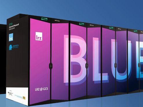
However, in addition to conventional digital image analysis, this requires artificial intelligence (AI) applications, and above all a lot of computing power and high-performance storage. Together with the DLR, the Leibniz Supercomputing Centre (LRZ) built terrabyte, a high-performance platform for the analysis of satellite and environmental data. terrabyte is now going into full operation: "In addition to very large computing capacities, terrabyte offers a high storage volume and enables classical simulations and evaluations based on AI methods," Prof. Dr. Dieter Kranzlmüller, head of the LRZ, explains. "terrabyte is also designed to be convenient for and accessible to researchers via the Internet."

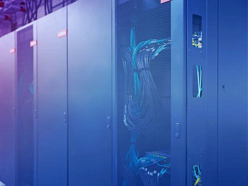
Satellite data from the DLR archive will be transmitted at 100 gigabits per second via a direct network connection to the High Performance Data Analytics platform (HPDA) at the LRZ. This platform combines traditional processors (CPU) with accelerators and graphics processing units (GPU). ThinkSystem SD650-N V2 servers and DSS-G storage from Lenovo will form the core of the new platform. For modelling, computation and AI analysis, they contain 61 CPU nodes, each equipped with two 40-core Intel Xeon Platinum processors, as well as 15 GPU nodes, each with four A100 accelerators from NVIDIA. Thanks to Infiniband HDR connections, terrabyte processes data at a speed of up to 320GB/s. "This means that terrabyte can currently achieve a performance of up to 1.3 petaflops," says Dr Reinhold Bader, a high-performance systems specialist at the LRZ. The platform can thus handle up to 1.3 quadrillion floating point calculations per second. By next autumn, the system will be expanded and terrabyte's performance will be more than doubled. The system is equipped with hot-water cooling to ensure an energy-efficient operation.

Similar to the LRZ Data Science Storages (DSS), the platform will have around 50 petabytes of additional online storage from autumn onwards. DLR researchers and scientists from Bavaria will be able to access the platform online and manage their data sets and calculations in as convenient a way as with commercial cloud services. " terrabyte takes the DLR's global Earth observation system to a new level. In future, we will be able to use it to independently and reliably detect and track comprehensive environmental changes such as those caused by urbanisation, agriculture and forestry, as well as those occurring in the atmosphere. And then we will have powerful tools to analyse them," says Prof. Dr Stefan Dech, director of the German Remote Sensing Data Center (DFD). "AI methods are helping to identify and understand the processes of environmental change in a better and faster way."

Technological alternatives for scientific research

terrabyte gives the natural and environmental sciences access to the treasure trove of data generated by the DLR's national satellite missions. Historical and current data on the state of the Earth can be used to highlight certain phenomena such as the melting of glaciers or polar ice caps, or to plan protective measures against floods, forest fires and droughts. The development of urban areas such as Shanghai can also be documented at shorter time intervals.

In addition to the operating system, the LRZ integrated the software stack for its high-performance computers (HPC) on terrabyte, as well as frequently used, freely available applications for HPC. The DLR implemented its own open-source software, tools and algorithms that can be used to analyse satellite data; Marconcini and his colleagues are currently installing the WSF tools on terrabyte: " Until now, the World Settlement Footprint has been calculated on commercial cloud systems, where we were not always able to perfectly adapt the available tools to our needs. On terrabyte, we can now develop our own algorithms and applications and optimise them together with scientists.

Envisaged by the DLR and the LRZ as a contribution to the strengthening of digital sovereignty and the reliable protection of research data, the platform offers DLR researchers the opportunity to work on the resolution of image data on global urbanisation. Today, providing better, i.e. higher resolution, images is no longer just the task of satellite and imaging technology, but in particular of smart image processing: AI tools supplement satellite data with the help of freely available, up-to-date photos of urban centres, they recalculate this information and process it to create new views: "AI is important when you need context for a map or a model and process data from additional sources for this," Marconcini says. terrabyte tools could, for example, automatically categorise buildings in cities. "For the settlement footprint, super-resolution is also mega-interesting, but still difficult to realise”, he adds. He and his colleagues are now working to achieve this goal using the HPDA platform: With the help of supercomputing and AI, they want to bring the resolution of the short-term WSF mapping to within 15 to 10 metres and that of the long-term mapping to within 5 to 2.5 metres, and they also want to calculate detailed 3D images so that they can estimate the height of buildings or their purpose and show the development of city districts even more precisely. "We also want to map the World Settlement Footprint at shorter time intervals, again something that would not be possible without AI," Marconcini adds. "But now we will soon be able to derive many scenarios from existing simulations within a short period of time. It's mind-boggling, amazing - maybe soon we'll be able to document changes in cities on a monthly or weekly basis."  (vs/ssc)

MM

Dr. Mattia Marconcini, Earth Observation Center at DLR


Portals and tools for the earth observation:

Open Geospatial Consortium
EOWEB Geo-Portal
GEO Knowledge Hub:
World Settlment Footprint (map)